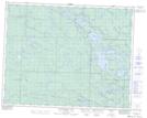
Maps showing Walton Creek, 29-23-13-E, Manitoba
Walton Creek is a River located in 29-23-13-E, Manitoba.
- Latitude: 50° 58' 56'' North (decimal: 50.9821999)
- Longitude: 95° 44' 49'' West (decimal: -95.7469000)
- Topography Feature Category: River
- Geographical Feature: Creek
- Canadian Province/Territory: Manitoba
- Location: 29-23-13-E
- Atlas of Canada Locator Map: Walton Creek
- GPS Coordinate Locator Map: Walton Creek Lat/Long
Walton Creek NTS Map Sheets