Canada Topographic Maps

Warrington River Topo Maps

Topography maps and Latitude/Longitude Location

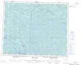
Maps showing Warrington River, Manitoba

Warrington River is a River located in Manitoba and has an elevation of 287 meters.

  • Latitude: 53° 6' 45'' North   (decimal: 53.1124999)
  • Longitude: 95° 2' 47'' West   (decimal: -95.0463999)
  • Topography Feature Category: River
  • Geographical Feature: River
  • Canadian Province/Territory: Manitoba
  • Elevation: 287 meters
  • Atlas of Canada Locator Map: Warrington River
  • GPS Coordinate Locator Map: Warrington River Lat/Long

Warrington River NTS Map Sheets

053D14 Acheetamo Lake Topographic Map at 1:50,000 scale

053D15 Cobham Lake Topographic Map at 1:50,000 scale

053E02 Gorman Lake Topographic Map at 1:50,000 scale

053E03 Lily Pad Lake Topographic Map at 1:50,000 scale

053D Deer Lake Topographic Map at 1:250,000 scale

053E Island Lake Topographic Map at 1:250,000 scale

 
Buy Topographic Maps DVD
Newsletter Sign-up

Yes, I want to receive map store discounts.


Bookmark and Share