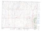
Maps showing Waskada, 5-2-25-W, Manitoba
Waskada is a Village located in 5-2-25-W, Manitoba and has an elevation of 473 meters.
- Latitude: 49° 5' 48'' North (decimal: 49.0966999)
- Longitude: 100° 48' 7'' West (decimal: -100.8019000)
- Topography Feature Category: Village
- Geographical Feature: Village
- Canadian Province/Territory: Manitoba
- Elevation: 473 meters
- Location: 5-2-25-W
- Atlas of Canada Locator Map: Waskada
- GPS Coordinate Locator Map: Waskada Lat/Long