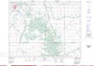
Maps showing Wellwood, 28-12-14-W, Manitoba
Wellwood is a Unincorporated area located in 28-12-14-W, Manitoba and has an elevation of 375 meters.
- Latitude: 50° 2' 23'' North (decimal: 50.0397000)
- Longitude: 99° 19' 56'' West (decimal: -99.3322000)
- Topography Feature Category: Unincorporated area
- Geographical Feature: Community
- Canadian Province/Territory: Manitoba
- Elevation: 375 meters
- Location: 28-12-14-W
- Atlas of Canada Locator Map: Wellwood
- GPS Coordinate Locator Map: Wellwood Lat/Long