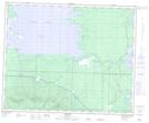
Maps showing West Branch Red Deer River, 28-45-28-W, Manitoba
West Branch Red Deer River is a River located in 28-45-28-W, Manitoba.
- Latitude: 52° 54' 21'' North (decimal: 52.9057999)
- Longitude: 101° 27' 43'' West (decimal: -101.4618999)
- Topography Feature Category: River
- Geographical Feature: Branch
- Canadian Province/Territory: Manitoba
- Location: 28-45-28-W
- Atlas of Canada Locator Map: West Branch Red Deer River
- GPS Coordinate Locator Map: West Branch Red Deer River Lat/Long