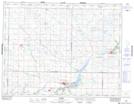
Maps showing Wheatland, 16,21-12-21-W, Manitoba
Wheatland is a Unincorporated area located in 16,21-12-21-W, Manitoba and has an elevation of 464 meters.
- Latitude: 50° 1' 0'' North (decimal: 50.0167000)
- Longitude: 100° 17' 44'' West (decimal: -100.2955999)
- Topography Feature Category: Unincorporated area
- Geographical Feature: Community
- Canadian Province/Territory: Manitoba
- Elevation: 464 meters
- Location: 16,21-12-21-W
- Atlas of Canada Locator Map: Wheatland
- GPS Coordinate Locator Map: Wheatland Lat/Long
Wheatland NTS Map Sheets