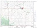
Maps showing Whitemud Creek, 23-2-18-W, Manitoba
Whitemud Creek is a River located in 23-2-18-W, Manitoba and has an elevation of 555 meters.
- Latitude: 49° 8' North (decimal: 49.1332999)
- Longitude: 99° 47' West (decimal: -99.7832999)
- Topography Feature Category: River
- Geographical Feature: Creek
- Canadian Province/Territory: Manitoba
- Elevation: 555 meters
- Location: 23-2-18-W
- Atlas of Canada Locator Map: Whitemud Creek
- GPS Coordinate Locator Map: Whitemud Creek Lat/Long