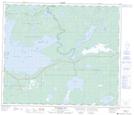
Maps showing Wickstendt Island, Manitoba
Wickstendt Island is a Island located in Manitoba.
- Latitude: 54° 38' North (decimal: 54.6333000)
- Longitude: 100° 25' West (decimal: -100.4167000)
- Topography Feature Category: Island
- Geographical Feature: Island
- Canadian Province/Territory: Manitoba
- GPS Coordinate Locator Map: Wickstendt Island Lat/Long
Wickstendt Island NTS Map Sheets