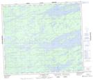
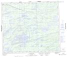
Maps showing Wilkins Lake, Manitoba
Wilkins Lake is a Lake located in Manitoba and has an elevation of 212 meters.
- Latitude: 55° 9' 6'' North (decimal: 55.1516999)
- Longitude: 96° 30' 1'' West (decimal: -96.5003000)
- Topography Feature Category: Lake
- Geographical Feature: Lake
- Canadian Province/Territory: Manitoba
- Elevation: 212 meters
- Atlas of Canada Locator Map: Wilkins Lake
- GPS Coordinate Locator Map: Wilkins Lake Lat/Long
Wilkins Lake NTS Map Sheets