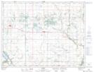
Maps showing Williamsons Marsh, 18,19-4-14-W, Manitoba
Williamsons Marsh is a Low vegetation located in 18,19-4-14-W, Manitoba and has an elevation of 449 meters.
- Latitude: 49° 18' 40'' North (decimal: 49.3110999)
- Longitude: 99° 20' 49'' West (decimal: -99.3468999)
- Topography Feature Category: Low vegetation
- Geographical Feature: Marsh
- Canadian Province/Territory: Manitoba
- Elevation: 449 meters
- Location: 18,19-4-14-W
- Atlas of Canada Locator Map: Williamsons Marsh
- GPS Coordinate Locator Map: Williamsons Marsh Lat/Long