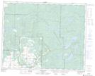
Maps showing Willow Lake, 11-32-27-W, Manitoba
Willow Lake is a Lake located in 11-32-27-W, Manitoba and has an elevation of 637 meters.
- Latitude: 51° 43' 23'' North (decimal: 51.7230999)
- Longitude: 101° 11' 39'' West (decimal: -101.1942000)
- Topography Feature Category: Lake
- Geographical Feature: Lake
- Canadian Province/Territory: Manitoba
- Elevation: 637 meters
- Location: 11-32-27-W
- Atlas of Canada Locator Map: Willow Lake
- GPS Coordinate Locator Map: Willow Lake Lat/Long
Willow Lake NTS Map Sheets