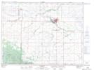
Maps showing Willow Swale, 10-1-19-W, Manitoba
Willow Swale is a Low vegetation located in 10-1-19-W, Manitoba and has an elevation of 642 meters.
- Latitude: 49° 1' 14'' North (decimal: 49.0205999)
- Longitude: 99° 56' 24'' West (decimal: -99.9399999)
- Topography Feature Category: Low vegetation
- Geographical Feature: Swale
- Canadian Province/Territory: Manitoba
- Elevation: 642 meters
- Location: 10-1-19-W
- Atlas of Canada Locator Map: Willow Swale
- GPS Coordinate Locator Map: Willow Swale Lat/Long