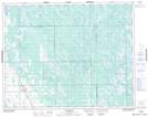
Maps showing Winthers Creek, 31-27-4-W, Manitoba
Winthers Creek is a River located in 31-27-4-W, Manitoba and has an elevation of 300 meters.
- Latitude: 51° 21' 38'' North (decimal: 51.3606000)
- Longitude: 98° 1' 23'' West (decimal: -98.0230999)
- Topography Feature Category: River
- Geographical Feature: Creek
- Canadian Province/Territory: Manitoba
- Elevation: 300 meters
- Location: 31-27-4-W
- Atlas of Canada Locator Map: Winthers Creek
- GPS Coordinate Locator Map: Winthers Creek Lat/Long
Winthers Creek NTS Map Sheets