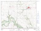
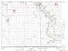
Maps showing Wokes Sloughs, 17-2-8-W, Manitoba
Wokes Sloughs is a Low vegetation located in 17-2-8-W, Manitoba and has an elevation of 475 meters.
- Latitude: 49° 7' 17'' North (decimal: 49.1214000)
- Longitude: 98° 29' 35'' West (decimal: -98.4931000)
- Topography Feature Category: Low vegetation
- Geographical Feature: Sloughs
- Canadian Province/Territory: Manitoba
- Elevation: 475 meters
- Location: 17-2-8-W
- Atlas of Canada Locator Map: Wokes Sloughs
- GPS Coordinate Locator Map: Wokes Sloughs Lat/Long
Wokes Sloughs NTS Map Sheets