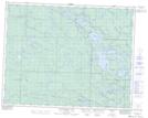
Maps showing Brooks Lake, 1,2,11,12-21-14-E, Manitoba
Brooks Lake is a Lake located in 1,2,11,12-21-14-E, Manitoba and has an elevation of 306 meters.
- Latitude: 50° 45' 53'' North (decimal: 50.7646999)
- Longitude: 95° 32' 14'' West (decimal: -95.5372000)
- Topography Feature Category: Lake
- Geographical Feature: Lake
- Canadian Province/Territory: Manitoba
- Elevation: 306 meters
- Location: 1,2,11,12-21-14-E
- Atlas of Canada Locator Map: Brooks Lake
- GPS Coordinate Locator Map: Brooks Lake Lat/Long
Brooks Lake NTS Map Sheets