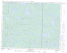
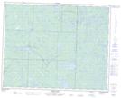
Maps showing Lavallee Lake, 20-21-16-E, Manitoba
Lavallee Lake is a Lake located in 20-21-16-E, Manitoba.
- Latitude: 50° 45' 1'' North (decimal: 50.7502999)
- Longitude: 95° 21' 41'' West (decimal: -95.3614000)
- Topography Feature Category: Lake
- Geographical Feature: Lake
- Canadian Province/Territory: Manitoba
- Location: 20-21-16-E
- Atlas of Canada Locator Map: Lavallee Lake
- GPS Coordinate Locator Map: Lavallee Lake Lat/Long
Lavallee Lake NTS Map Sheets