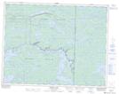
Maps showing LeVasseur Island, 15,16-17-E, Manitoba
LeVasseur Island is a Island located in 15,16-17-E, Manitoba and has an elevation of 303 meters.
- Latitude: 50° 18' 57'' North (decimal: 50.3157999)
- Longitude: 95° 11' 42'' West (decimal: -95.1949999)
- Topography Feature Category: Island
- Geographical Feature: Island
- Canadian Province/Territory: Manitoba
- Elevation: 303 meters
- Location: 15,16-17-E
- Atlas of Canada Locator Map: LeVasseur Island
- GPS Coordinate Locator Map: LeVasseur Island Lat/Long
LeVasseur Island NTS Map Sheets