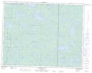
Maps showing Lundmark Lake, 19-17-E, Manitoba
Lundmark Lake is a Lake located in 19-17-E, Manitoba.
- Latitude: 50° 39' 18'' North (decimal: 50.6550000)
- Longitude: 95° 11' 31'' West (decimal: -95.1918999)
- Topography Feature Category: Lake
- Geographical Feature: Lake
- Canadian Province/Territory: Manitoba
- Location: 19-17-E
- Atlas of Canada Locator Map: Lundmark Lake
- GPS Coordinate Locator Map: Lundmark Lake Lat/Long
Lundmark Lake NTS Map Sheets