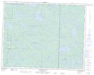
Maps showing Stamm Lake, 19-16-E, Manitoba
Stamm Lake is a Lake located in 19-16-E, Manitoba.
- Latitude: 50° 35' 13'' North (decimal: 50.5868999)
- Longitude: 95° 16' 9'' West (decimal: -95.2692000)
- Topography Feature Category: Lake
- Geographical Feature: Lake
- Canadian Province/Territory: Manitoba
- Location: 19-16-E
- Atlas of Canada Locator Map: Stamm Lake
- GPS Coordinate Locator Map: Stamm Lake Lat/Long
Stamm Lake NTS Map Sheets