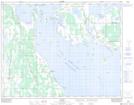
Maps showing Dog Creek, 22-9-W, Manitoba
Dog Creek is a Unincorporated area located in 22-9-W, Manitoba and has an elevation of 249 meters.
- Latitude: 50° 54' 30'' North (decimal: 50.9083000)
- Longitude: 98° 35' 50'' West (decimal: -98.5972000)
- Topography Feature Category: Unincorporated area
- Geographical Feature: Community
- Canadian Province/Territory: Manitoba
- Elevation: 249 meters
- Location: 22-9-W
- Atlas of Canada Locator Map: Dog Creek
- GPS Coordinate Locator Map: Dog Creek Lat/Long