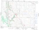
Maps showing Gambler, 19-29-W, Manitoba
Gambler is a Unincorporated area located in 19-29-W, Manitoba and has an elevation of 461 meters.
- Latitude: 50° 35' 42'' North (decimal: 50.5949999)
- Longitude: 101° 23' 00'' West (decimal: -101.3833000)
- Topography Feature Category: Unincorporated area
- Geographical Feature: Community
- Canadian Province/Territory: Manitoba
- Elevation: 461 meters
- Location: 19-29-W
- Atlas of Canada Locator Map: Gambler
- GPS Coordinate Locator Map: Gambler Lat/Long
Gambler NTS Map Sheets