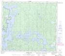
Maps showing Prayer River, 80-20-W, Manitoba
Prayer River is a Unincorporated area located in 80-20-W, Manitoba.
- Latitude: 55° 54' 40'' North (decimal: 55.9111000)
- Longitude: 100° 25' 45'' West (decimal: -100.4292000)
- Topography Feature Category: Unincorporated area
- Geographical Feature: Community
- Canadian Province/Territory: Manitoba
- Location: 80-20-W
- Atlas of Canada Locator Map: Prayer River
- GPS Coordinate Locator Map: Prayer River Lat/Long
Prayer River NTS Map Sheets