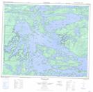
Maps showing Waasagomach Bay, 57-17,18-E, Manitoba
Waasagomach Bay is a Unincorporated area located in 57-17,18-E, Manitoba.
- Latitude: 53° 54' 30'' North (decimal: 53.9082999)
- Longitude: 94° 56' 45'' West (decimal: -94.9457999)
- Topography Feature Category: Unincorporated area
- Geographical Feature: Post Office
- Canadian Province/Territory: Manitoba
- Location: 57-17,18-E
- GPS Coordinate Locator Map: Waasagomach Bay Lat/Long
Waasagomach Bay NTS Map Sheets