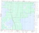
Maps showing Fir Pond, 20-58-26-W, Manitoba
Fir Pond is a Lake located in 20-58-26-W, Manitoba.
- Latitude: 54° 1' 48'' North (decimal: 54.0300000)
- Longitude: 101° 17' 13'' West (decimal: -101.2869000)
- Topography Feature Category: Lake
- Geographical Feature: Pond
- Canadian Province/Territory: Manitoba
- Location: 20-58-26-W
- Atlas of Canada Locator Map: Fir Pond
- GPS Coordinate Locator Map: Fir Pond Lat/Long
Fir Pond NTS Map Sheets