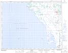
Maps showing Lundar Pond, 7-20-4-W, Manitoba
Lundar Pond is a Lake located in 7-20-4-W, Manitoba and has an elevation of 259 meters.
- Latitude: 50° 41' 59'' North (decimal: 50.6997000)
- Longitude: 98° 0' 29'' West (decimal: -98.0081000)
- Topography Feature Category: Lake
- Geographical Feature: Pond
- Canadian Province/Territory: Manitoba
- Elevation: 259 meters
- Location: 7-20-4-W
- Atlas of Canada Locator Map: Lundar Pond
- GPS Coordinate Locator Map: Lundar Pond Lat/Long