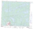
Maps showing Cope Lake, 15-67-29-W, Manitoba
Cope Lake is a Lake located in 15-67-29-W, Manitoba and has an elevation of 328 meters.
- Latitude: 54° 47' 40'' North (decimal: 54.7944000)
- Longitude: 101° 47' 50'' West (decimal: -101.7971999)
- Topography Feature Category: Lake
- Geographical Feature: Lake
- Canadian Province/Territory: Manitoba
- Elevation: 328 meters
- Location: 15-67-29-W
- Atlas of Canada Locator Map: Cope Lake
- GPS Coordinate Locator Map: Cope Lake Lat/Long
Cope Lake NTS Map Sheets