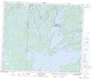
Maps showing Sharpe Bay, 9,10-66-28-W, Manitoba
Sharpe Bay is a Bay located in 9,10-66-28-W, Manitoba and has an elevation of 299 meters.
- Latitude: 54° 41' 52'' North (decimal: 54.6977999)
- Longitude: 101° 37' 5'' West (decimal: -101.6180999)
- Topography Feature Category: Bay
- Geographical Feature: Bay
- Canadian Province/Territory: Manitoba
- Elevation: 299 meters
- Location: 9,10-66-28-W
- Atlas of Canada Locator Map: Sharpe Bay
- GPS Coordinate Locator Map: Sharpe Bay Lat/Long
Sharpe Bay NTS Map Sheets