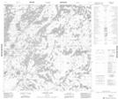
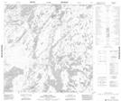
Maps showing John Osborn Lake, Manitoba
John Osborn Lake is a Lake located in Manitoba.
- Latitude: 59° 47' 35'' North (decimal: 59.7931000)
- Longitude: 99° 11' 45'' West (decimal: -99.1958000)
- Topography Feature Category: Lake
- Geographical Feature: Lake
- Canadian Province/Territory: Manitoba
- Atlas of Canada Locator Map: John Osborn Lake
- GPS Coordinate Locator Map: John Osborn Lake Lat/Long
John Osborn Lake NTS Map Sheets