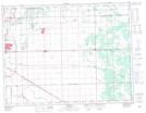
Maps showing Cooks Creek Diversion, Manitoba
Cooks Creek Diversion is a Hydraulic construction located in Manitoba.
- Latitude: 49° 54' 11'' North (decimal: 49.9031000)
- Longitude: 96° 57' 9'' West (decimal: -96.9525000)
- Topography Feature Category: Hydraulic construction
- Geographical Feature: Diversion
- Canadian Province/Territory: Manitoba
- Atlas of Canada Locator Map: Cooks Creek Diversion
- GPS Coordinate Locator Map: Cooks Creek Diversion Lat/Long