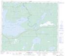
Maps showing Jackfish Lake Creek, Manitoba
Jackfish Lake Creek is a River located in Manitoba.
- Latitude: 54° 39' 58'' North (decimal: 54.6661000)
- Longitude: 100° 21' 5'' West (decimal: -100.3513999)
- Topography Feature Category: River
- Geographical Feature: Creek
- Canadian Province/Territory: Manitoba
- Atlas of Canada Locator Map: Jackfish Lake Creek
- GPS Coordinate Locator Map: Jackfish Lake Creek Lat/Long
Jackfish Lake Creek NTS Map Sheets