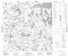
Maps showing Onhauser Lake, Manitoba
Onhauser Lake is a Lake located in Manitoba.
- Latitude: 59° 59' 3'' North (decimal: 59.9842000)
- Longitude: 98° 10' 17'' West (decimal: -98.1714000)
- Topography Feature Category: Lake
- Geographical Feature: Lake
- Canadian Province/Territory: Manitoba
- Atlas of Canada Locator Map: Onhauser Lake
- GPS Coordinate Locator Map: Onhauser Lake Lat/Long
Onhauser Lake NTS Map Sheets