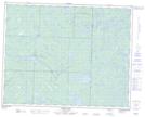
Maps showing Shelley Lake, 28,29-23-16-E, Manitoba
Shelley Lake is a Lake located in 28,29-23-16-E, Manitoba.
- Latitude: 50° 59' 9'' North (decimal: 50.9857999)
- Longitude: 95° 19' 3'' West (decimal: -95.3174999)
- Topography Feature Category: Lake
- Geographical Feature: Lake
- Canadian Province/Territory: Manitoba
- Location: 28,29-23-16-E
- Atlas of Canada Locator Map: Shelley Lake
- GPS Coordinate Locator Map: Shelley Lake Lat/Long
Shelley Lake NTS Map Sheets