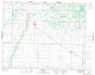
Maps showing Swystun Lake, 25-19-23-W, Manitoba
Swystun Lake is a Lake located in 25-19-23-W, Manitoba and has an elevation of 612 meters.
- Latitude: 50° 39' 31'' North (decimal: 50.6585999)
- Longitude: 100° 32' 38'' West (decimal: -100.5438999)
- Topography Feature Category: Lake
- Geographical Feature: Lake
- Canadian Province/Territory: Manitoba
- Elevation: 612 meters
- Location: 25-19-23-W
- Atlas of Canada Locator Map: Swystun Lake
- GPS Coordinate Locator Map: Swystun Lake Lat/Long
Swystun Lake NTS Map Sheets