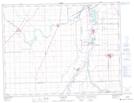
Maps showing Hogue Dam, 26-8-E1, Manitoba
Hogue Dam is a Hydraulic construction located in 26-8-E1, Manitoba.
- Latitude: 49° 41' 4'' North (decimal: 49.6844000)
- Longitude: 97° 20' 44'' West (decimal: -97.3456000)
- Topography Feature Category: Hydraulic construction
- Geographical Feature: Dam
- Canadian Province/Territory: Manitoba
- Location: 26-8-E1
- Atlas of Canada Locator Map: Hogue Dam
- GPS Coordinate Locator Map: Hogue Dam Lat/Long
Hogue Dam NTS Map Sheets