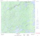
Maps showing Kame Hills Lake, Manitoba
Kame Hills Lake is a Lake located in Manitoba.
- Latitude: 57° 28' 7'' North (decimal: 57.4685999)
- Longitude: 98° 38' 8'' West (decimal: -98.6355999)
- Topography Feature Category: Lake
- Geographical Feature: Lake
- Canadian Province/Territory: Manitoba
- Atlas of Canada Locator Map: Kame Hills Lake
- GPS Coordinate Locator Map: Kame Hills Lake Lat/Long
Kame Hills Lake NTS Map Sheets