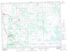
Maps showing Pansy Drain, 21-5-6-E1, Manitoba
Pansy Drain is a Hydraulic construction located in 21-5-6-E1, Manitoba and has an elevation of 283 meters.
- Latitude: 49° 24' 31'' North (decimal: 49.4085999)
- Longitude: 96° 43' 47'' West (decimal: -96.7296999)
- Topography Feature Category: Hydraulic construction
- Geographical Feature: Drain
- Canadian Province/Territory: Manitoba
- Elevation: 283 meters
- Location: 21-5-6-E1
- Atlas of Canada Locator Map: Pansy Drain
- GPS Coordinate Locator Map: Pansy Drain Lat/Long