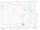
Maps showing Seine River Diversion Dam, Manitoba
Seine River Diversion Dam is a Hydraulic construction located in Manitoba and has an elevation of 258 meters.
- Latitude: 49° 39' 29'' North (decimal: 49.6580999)
- Longitude: 96° 38' 8'' West (decimal: -96.6356000)
- Topography Feature Category: Hydraulic construction
- Geographical Feature: Dam
- Canadian Province/Territory: Manitoba
- Elevation: 258 meters
- Atlas of Canada Locator Map: Seine River Diversion Dam
- GPS Coordinate Locator Map: Seine River Diversion Dam Lat/Long