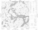
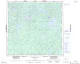
Maps showing Douglas Bay, Manitoba
Douglas Bay is a Bay located in Manitoba.
- Latitude: 58° 48' 55'' North (decimal: 58.8152999)
- Longitude: 98° 45' 40'' West (decimal: -98.7611000)
- Topography Feature Category: Bay
- Geographical Feature: Bay
- Canadian Province/Territory: Manitoba
- Atlas of Canada Locator Map: Douglas Bay
- GPS Coordinate Locator Map: Douglas Bay Lat/Long
Douglas Bay NTS Map Sheets