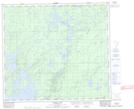
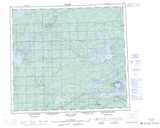
Maps showing Gates Island, Manitoba
Gates Island is a Island located in Manitoba.
- Latitude: 56° 32' 13'' North (decimal: 56.5369000)
- Longitude: 97° 55' 2'' West (decimal: -97.9172000)
- Topography Feature Category: Island
- Geographical Feature: Island
- Canadian Province/Territory: Manitoba
- Atlas of Canada Locator Map: Gates Island
- GPS Coordinate Locator Map: Gates Island Lat/Long
Gates Island NTS Map Sheets