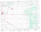
Maps showing Station Road Drain, 32-9-5-E, Manitoba
Station Road Drain is a Hydraulic construction located in 32-9-5-E, Manitoba.
- Latitude: 49° 47' 48'' North (decimal: 49.7967000)
- Longitude: 96° 52' 45'' West (decimal: -96.8792000)
- Topography Feature Category: Hydraulic construction
- Geographical Feature: Drain
- Canadian Province/Territory: Manitoba
- Location: 32-9-5-E
- Atlas of Canada Locator Map: Station Road Drain
- GPS Coordinate Locator Map: Station Road Drain Lat/Long