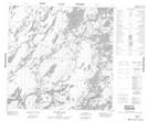
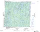
Maps showing Lang Point, 121-18-W1, Manitoba
Lang Point is a Cape located in 121-18-W1, Manitoba.
- Latitude: 59° 31' 30'' North (decimal: 59.5249999)
- Longitude: 100° 28' 20'' West (decimal: -100.4721999)
- Topography Feature Category: Cape
- Geographical Feature: Point
- Canadian Province/Territory: Manitoba
- Location: 121-18-W1
- Atlas of Canada Locator Map: Lang Point
- GPS Coordinate Locator Map: Lang Point Lat/Long
Lang Point NTS Map Sheets