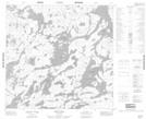
Maps showing Cantin Island, 113-10-W1, Manitoba
Cantin Island is a Island located in 113-10-W1, Manitoba.
- Latitude: 58° 49' 17'' North (decimal: 58.8214000)
- Longitude: 99° 4' 1'' West (decimal: -99.0668999)
- Topography Feature Category: Island
- Geographical Feature: Island
- Canadian Province/Territory: Manitoba
- Location: 113-10-W1
- Atlas of Canada Locator Map: Cantin Island
- GPS Coordinate Locator Map: Cantin Island Lat/Long
Cantin Island NTS Map Sheets