Maps showing Weir Island, 119,120-24-W1, Manitoba
Weir Island is a Island located in 119,120-24-W1, Manitoba.
- Latitude: 59° 23' 3'' North (decimal: 59.3841999)
- Longitude: 101° 32' 00'' West (decimal: -101.5333000)
- Topography Feature Category: Island
- Geographical Feature: Island
- Canadian Province/Territory: Manitoba
- Location: 119,120-24-W1
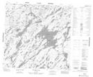
- Atlas of Canada Locator Map: Weir Island
- GPS Coordinate Locator Map: Weir Island Lat/Long
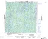
Weir Island NTS Map Sheets