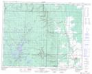
Maps showing Beaver Lake Dam, 5-33-24-W, Manitoba
Beaver Lake Dam is a Hydraulic construction located in 5-33-24-W, Manitoba.
- Latitude: 51° 48' 10'' North (decimal: 51.8028000)
- Longitude: 100° 49' 57'' West (decimal: -100.8324999)
- Topography Feature Category: Hydraulic construction
- Geographical Feature: Dam
- Canadian Province/Territory: Manitoba
- Location: 5-33-24-W
- Atlas of Canada Locator Map: Beaver Lake Dam
- GPS Coordinate Locator Map: Beaver Lake Dam Lat/Long
Beaver Lake Dam NTS Map Sheets