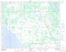
Maps showing Swan Lake Dam, 12,13-21-6-W1, Manitoba
Swan Lake Dam is a Hydraulic construction located in 12,13-21-6-W1, Manitoba and has an elevation of 258 meters.
- Latitude: 50° 48' 4'' North (decimal: 50.8011000)
- Longitude: 98° 10' 10'' West (decimal: -98.1693999)
- Topography Feature Category: Hydraulic construction
- Geographical Feature: Dam
- Canadian Province/Territory: Manitoba
- Elevation: 258 meters
- Location: 12,13-21-6-W1
- Atlas of Canada Locator Map: Swan Lake Dam
- GPS Coordinate Locator Map: Swan Lake Dam Lat/Long