Canada Topographic Maps

Johnson River Topo Maps

Topography maps and Latitude/Longitude Location

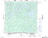
Maps showing Johnson River, Manitoba

Johnson River is a River located in Manitoba.

  • Latitude: 58° 55' 35'' North   (decimal: 58.9264000)
  • Longitude: 99° 3' 0'' West   (decimal: -99.0500000)
  • Topography Feature Category: River
  • Geographical Feature: River
  • Canadian Province/Territory: Manitoba
  • Atlas of Canada Locator Map: Johnson River
  • GPS Coordinate Locator Map: Johnson River Lat/Long

Johnson River NTS Map Sheets

064J05 Sprott Lake Topographic Map at 1:50,000 scale

064J11 Lunney Lake Topographic Map at 1:50,000 scale

064J12 Clisby Lake Topographic Map at 1:50,000 scale

064J14 Bain Lake Topographic Map at 1:50,000 scale

064J Tadoule Lake Topographic Map at 1:250,000 scale

 
Buy Topographic Maps DVD
Newsletter Sign-up

Yes, I want to receive map store discounts.


Bookmark and Share