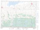
Maps showing L-8 Dam, 26-2-23-W1, Manitoba
L-8 Dam is a Hydraulic construction located in 26-2-23-W1, Manitoba.
- Latitude: 49° 9' 3'' North (decimal: 49.1507999)
- Longitude: 100° 26' 47'' West (decimal: -100.4463999)
- Topography Feature Category: Hydraulic construction
- Geographical Feature: Dam
- Canadian Province/Territory: Manitoba
- Location: 26-2-23-W1
- Atlas of Canada Locator Map: L-8 Dam
- GPS Coordinate Locator Map: L-8 Dam Lat/Long