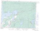
Maps showing Willow Reef, SW35-16-12-E, Manitoba
Willow Reef is a Shoal located in SW35-16-12-E, Manitoba.
- Latitude: 50° 23' 13'' North (decimal: 50.3868999)
- Longitude: 95° 51' 00'' West (decimal: -95.8499999)
- Topography Feature Category: Shoal
- Geographical Feature: Reef
- Canadian Province/Territory: Manitoba
- Location: SW35-16-12-E
- Atlas of Canada Locator Map: Willow Reef
- GPS Coordinate Locator Map: Willow Reef Lat/Long
Willow Reef NTS Map Sheets