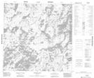
Maps showing Reid Bay, Manitoba
Reid Bay is a Bay located in Manitoba and has an elevation of 290 meters.
- Latitude: 59° 31' 55'' North (decimal: 59.5319000)
- Longitude: 99° 45' 50'' West (decimal: -99.7639000)
- Topography Feature Category: Bay
- Geographical Feature: Bay
- Canadian Province/Territory: Manitoba
- Elevation: 290 meters
- Atlas of Canada Locator Map: Reid Bay
- GPS Coordinate Locator Map: Reid Bay Lat/Long
Reid Bay NTS Map Sheets