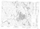
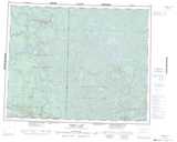
Maps showing Waddell Island, 16-30-13-E1, Manitoba
Waddell Island is a Island located in 16-30-13-E1, Manitoba.
- Latitude: 51° 34' 45'' North (decimal: 51.5791999)
- Longitude: 95° 41' 27'' West (decimal: -95.6908000)
- Topography Feature Category: Island
- Geographical Feature: Island
- Canadian Province/Territory: Manitoba
- Location: 16-30-13-E1
- Atlas of Canada Locator Map: Waddell Island
- GPS Coordinate Locator Map: Waddell Island Lat/Long
Waddell Island NTS Map Sheets